

Seoul is one of the rare megacities where you can leave the subway, walk into a national park, and stand on a granite summit before lunch. Bukhansan National Park rises along the northern edge of the city, offering forested valleys, historic fortress gates, exposed rock ridges, and wide views over Seoul.
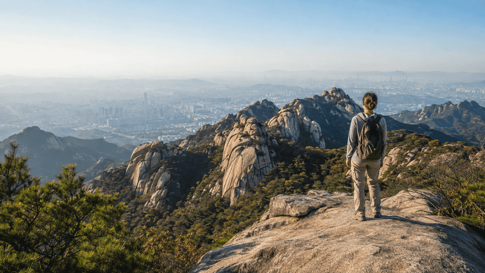
The park is easy to reach without a car, but choosing a trail can be confusing. “Bukhansan” may refer to the southern Bukhansan area or, more broadly, the national park that also includes Dobongsan to the north. Trailheads sit in different neighborhoods, and two routes with similar distances can feel very different once steep granite and fixed cables are involved.
This guide narrows the options to five useful routes for travelers. Times are approximate round-trip estimates for hikers taking normal breaks. Weather, crowds, navigation, and fitness can add considerably more time.
Hiking in Seoul as a foreign resident
If you live in Korea, Bukhansan is one of the best day hikes from Seoul for a weekend outdoors. You can reach the main trailheads by subway and bus, and you do not need a car or a Korean hiking club to get started. This guide uses the English names you are likely to see in travel searches, along with Korean place names you can paste into Naver Map or KakaoMap.
For a first hike in Korea, save the trailhead and return route before leaving your accommodation. Google Maps is useful for broad orientation, but local map apps are generally better for Korean bus stops, walking directions, and the last few hundred meters to a visitor center. Download or screenshot the route because mountain reception can be inconsistent.
Useful searches include Bukhansan hiking, best hikes in Seoul, Seoul mountain hiking, and easy hikes near Seoul. The right choice depends more on the exposed sections and elevation gain than on the distance shown in an app.
Quick answers for first-time visitors
Is Bukhansan good for beginners? Yes, if you choose a valley or fortress route and are comfortable walking uphill for several hours. Baegundae and the exposed Bibong ridge are better for hikers with suitable shoes and previous mountain experience.
Can you hike Bukhansan without speaking Korean? Usually. Major signs often include English, and the visitor centers are accustomed to hikers, but saving Korean trailhead names and carrying a charged phone makes navigation much easier.
What is the easiest way to get to Bukhansan from central Seoul? The Ui–Sinseol Line to Bukhansan Ui Station is convenient for the Ui-side trails. Gugi and Bukhansanseong require a bus or taxi connection, while Dobongsan is served directly by Lines 1 and 7.
Do you need to book a Bukhansan hike? Most ordinary day hikes do not require advance booking. Trail closures and controlled sections can change, so check the Korea National Park Service notice before departure.
Which Bukhansan route should you choose?
| Route | Best for | Difficulty | Approx. round trip |
|---|---|---|---|
| Sogwicheon Valley to Daedongmun | A gentler forest walk | Easy to moderate | 3–4 hours |
| Bukhansan Ui to Baegundae | Reaching Seoul’s highest peak | Hard | 4–6 hours |
| Gugi to Bibong and Samobawi | Big views and photography | Moderate to hard | 4–5 hours |
| Bukhansanseong to Daenammun | Valleys, gates, and history | Moderate | 5–7 hours |
| Dobongsan to Sinseondae | Dramatic rocky scenery | Hard | 4–6 hours |
If this is your first Korean mountain hike, do not choose by distance alone. The Korea National Park Service grades trails using slope, distance, surface, and expected time. A short section over smooth, steep granite may demand more care than a longer forest path.
1. Sogwicheon Valley to Daedongmun: the approachable choice
Route: Bukhansan Ui Station → Sogwicheon Valley → Daedongmun Gate → return the same way
Best for: Casual hikers, warm-weather shade, and visitors who prefer a trail over a summit scramble
Sogwicheon is a good introduction to Bukhansan. The path follows a wooded valley before climbing toward Daedongmun, one of the gates in the old Bukhansanseong Fortress wall. It lacks the exposed summit drama of Baegundae, but the gentler terrain makes it a better fit if you have limited hiking experience or want to keep some energy for the rest of your Seoul itinerary.
The official Seoul Hiking Tourism Center guide describes the lower Sogwicheon trail as beginner-friendly. Continuing all the way to Daedongmun adds climbing, so treat the full out-and-back route as an easy-to-moderate hike rather than a casual city stroll.
Getting there: Take the Ui–Sinseol Line to Bukhansan Ui Station. Use Exit 2 and follow signs toward the mountain and the Seoul Hiking Tourism Center.
Map: Google Maps · Naver Map
2. Bukhansan Ui to Baegundae: the classic summit hike
Route: Bukhansan Ui area → Baegundae Visitor Center → Haroojae Pass → Baegun Shelter → Baegunbongammun Gate → Baegundae → return
Summit: Baegundae, 836.5 meters
Best for: Fit hikers who want the park’s signature experience
Baegundae is the highest point in Bukhansan and Seoul’s most famous mountain summit. The route from the Ui side is the most straightforward choice for travelers using public transportation. Along the way, you get close views of Insubong’s massive granite face before the trail steepens toward the summit.
The final section is the part to take seriously. You must move over exposed rock while holding fixed cables. It can feel intimidating in strong wind and becomes dangerously slippery after rain, snow, or freezing weather. Wear proper hiking shoes with grip, keep both hands available, and turn around if conditions are poor. Weekend queues near the summit can also slow the hike.
Getting there: Take the Ui–Sinseol Line to Bukhansan Ui Station. From the station, it is roughly 2–2.5 kilometers uphill on a paved road to the Baegundae Visitor Center near Doseonsa Temple, adding about 35–45 minutes before the mountain trail begins.
The local “squirrel taxi” shortcut
Near Exit 2, hikers often share taxis that repeatedly shuttle between Bukhansan Ui and the Baegundae Visitor Center/Doseonsa entrance. Locals informally call them “daramjwi taxi” (다람쥐택시), or “squirrel taxis,” because they run back and forth over the same short route.
A local Bukhansan hiking guide and recent traveler reports describe the boarding point as about 60 meters to the left of Exit 2, in front of the former Ediya Coffee location. A car usually leaves once four passengers have gathered. The commonly reported uphill fare is about KRW 2,000 per person, and the ride takes approximately 8–10 minutes. Tell the driver “Baegundae Tambang Jiwon Center” (백운대탐방지원센터) or show the Korean name on your phone. This drops you near the Doseonsa entrance and removes the long paved climb, but it does not take you to Baegundae Peak itself.
This is an informal shared-taxi practice, not a scheduled park shuttle or an officially fixed per-person fare. Seoul has previously warned that taxi pooling and operating without the meter can violate taxi regulations. Availability, boarding location, waiting time, and price may therefore change without notice. Confirm the fare before getting in; if no shared car is operating—or if you prefer the standard option—use a regular metered taxi to the visitor center.
For reference, the official Seoul Hiking Tourism Center course map also notes that visitors can take a taxi from Bukhansan Ui Station to the Baegundae Visitor Center. The “squirrel taxi” nickname and per-person arrangement come from local usage rather than the tourism center.
Map: Bukhansan Ui Station on Google Maps · Bukhansan Ui Station on Naver Map · Baegundae Visitor Center on Naver Map
3. Gugi to Bibong and Samobawi: the best ridge views
Route: Gugi Visitor Center → Gugi Valley → Seungasa Temple → Bibong → Samobawi → return or descend by a planned connecting trail
Best for: Experienced walkers, skyline views, and photography
For views rather than a highest-point checklist, the Bibong ridge is hard to beat. The trail climbs from Gugi-dong past a valley and Seungasa Temple, then opens onto a rocky ridge with striking views of Bukhansan’s peaks and central Seoul.
Bibong is associated with a monument erected during the reign of King Jinheung of Silla; the monument on the summit is a replica, while the original is preserved by the National Museum of Korea. Nearby Samobawi is a distinctive hat-shaped rock and a popular rest and photo spot.
The ridge includes steep and exposed sections. You do not need to climb every rock you see: use the signed bypasses, especially at Bibong. Extending the hike from Samobawi toward Seungabong and Munsubong creates a much harder ridge day and is not recommended for first-time hikers.
Getting there: There is no subway station directly at the Gugi trailhead. Use a Seoul transit app to plan a bus to Gugi-dong or Gugi Tunnel, then walk to the Gugi Visitor Center. Save the Korean name 구기탐방지원센터 for easier map searches.
Map: Google Maps · Naver Map
4. Bukhansanseong to Daenammun: scenery with a history lesson
Route: Bukhansanseong Visitor Center → Daeseomun Gate → Jungseongmun Gate → valley trail → Daenammun Gate → return
Best for: Travelers interested in fortress architecture and a less exposed hike
This western approach follows a broad valley into the historic Bukhansanseong Fortress area. Stone gates, sections of wall, temples, and mountain streams give the route more cultural variety than a summit-only hike. Daenammun sits on the main ridge and provides a satisfying destination without requiring the cable-assisted climb to Baegundae.
The hike is still substantial. There is sustained uphill walking to Daenammun, and adding Munsubong or continuing along the ridge changes it into a harder trip. Start early and return by the same route unless you have mapped a through-hike and confirmed your exit transportation.
Getting there: From Gupabal Station on Line 3, take a bus toward Bukhansanseong Entrance and walk to the visitor center. Bus numbers and stops can change, so confirm the route in Naver Map or KakaoMap on the day of travel.
Map: Google Maps · Naver Map
5. Dobongsan to Sinseondae: a dramatic alternative
Route: Dobongsan Visitor Center → Madangbawi → Sinseondae → return
Best for: Strong hikers who want sharp granite peaks and a direct subway approach
Dobongsan forms the northern part of Bukhansan National Park. Its cluster of bare granite peaks—Jaunbong, Manjangbong, Seoninbong, and Sinseondae—creates some of the park’s most dramatic scenery. Sinseondae is the accessible hiking summit; neighboring rock faces are technical climbing territory.
Expect a steep finish with railings or fixed handholds and crowded rock slabs on popular days. Avoid this route in wet or icy conditions. If Baegundae is the famous first choice, Sinseondae is the excellent second hike for visitors who want a different side of the park.
Getting there: Take Line 1 or Line 7 to Dobongsan Station, then follow signs and the streamside road toward the national park entrance.
Map: Google Maps · Naver Map
Renting hiking gear near Bukhansan Ui Station
You do not necessarily need to pack boots and trekking poles for your entire trip to Korea. The Seoul Hiking Tourism Center – Bukhansan is about a five-minute walk from Exit 2 of Bukhansan Ui Station. It offers services aimed at international visitors, including hiking-gear rental, route information, luggage storage, and changing facilities.
Gear availability and opening days can change, and advance reservations may be required. Check the Seoul Hiking Tourism Center website before visiting rather than relying on an old timetable.
What to bring
- Hiking shoes with reliable grip; ordinary fashion sneakers are a poor choice for wet granite
- At least 1–2 liters of water per person, plus snacks or a packed meal
- A charged phone, portable battery, and an offline screenshot of your route
- A light insulating layer and windproof shell, even when central Seoul feels warm
- Sun protection in summer; gloves and traction devices when winter conditions require them
- A small rubbish bag—carry everything back out
Convenience stores and restaurants are common near major entrances, but do not assume that water or food will be available higher on the mountain.
Navigation and Korean place names
Google Maps is less useful for detailed navigation in Korea than local apps. Naver Map and KakaoMap provide better public-transport directions, and both can search English names. Saving the Korean trailhead name is still helpful:
| Place | Google Maps | Naver Map |
|---|---|---|
| Bukhansan Ui Station (북한산우이역) | Open map | Open map |
| Baegundae Peak (백운대) | Open map | Open map |
| Gugi Visitor Center (구기탐방지원센터) | Open map | Open map |
| Bukhansanseong Visitor Center (북한산성탐방지원센터) | Open map | Open map |
| Dobongsan Station (도봉산역) | Open map | Open map |
Trail junction signs usually show Korean and English, but romanization is not always consistent. For example, Baegundae may appear with slightly different spellings across older signs and maps. Match the Korean characters when in doubt.
Safety, weather, and park rules
Start in the morning and plan to be off exposed ridges well before sunset. Bukhansan uses designated trail-entry hours, and individual trails may close because of wildfire risk, heavy rain, snow, rockfall, maintenance, or rescue operations. Check the Korea National Park Service’s Bukhansan page for notices and trail controls on the morning of your hike.
Avoid ridge routes during thunderstorms, high winds, or after heavy rain. In an emergency, call 119 for fire and rescue services. Trail signs often display location codes; photograph or report the nearest code when asking for help.
Stay on marked trails, do not feed wildlife, and take your rubbish with you. Most ordinary day hikes do not require a reservation, but controlled trails can have separate rules. Uiryeong-gil, for example, has its own access arrangements, so confirm current requirements through the Korea National Park Reservation System before making it part of your plan.
The best first hike for most visitors
Choose Baegundae from the Ui side if you are fit, have suitable footwear, and the rock is dry. It delivers the classic granite summit and city panorama in a single day. Choose Sogwicheon Valley if you want a calmer forest experience, or Bibong and Samobawi if ridge scenery matters more than reaching the highest point.
Whichever route you choose, leave room in the schedule. Bukhansan is not simply a viewpoint above Seoul; it is a real mountain landscape with steep terrain and fast-changing conditions. An early start, the right shoes, and a conservative turnaround time will make it one of the most memorable days of your trip to Korea.
Official resources
- Korea National Park Service: Bukhansan National Park
- Korea National Park Reservation System
- Seoul Hiking Tourism Center
- Seoul Hiking Guide Book (English PDF)
- Seoul Metropolitan Government notice on informal “squirrel taxis” (Korean)
Trail conditions, access hours, transit routes, and facility operations can change. This guide was prepared on September 7, 2026; check official notices before departure.